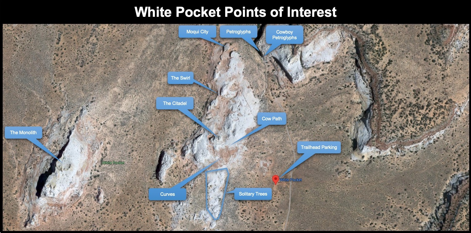

This was a location I have longed to visit. When I found that I had won the online lottery to hike the wave, I decided that I should try and visit White Pocket, since the entrance onto the road is just South of the Wire Pass Trailhead on House Rock Valley Road as shown below.
What has kept me from visiting sooner has been the lack of confidence in driving in deep sand anyone visiting has to do for like 15 miles. I even outfitted my Jeep Grand Cherokee Trail Hawk with recovery tracks, tow cables, and tools to air down a few years back. But winning a permit to the Wave enticed me to look for as much information posted on the internet. One blog posting titled White Pocket, a Great Alternative to the Wave in Arizona by that Adventure Life couple offered detailed information on how to get there with reference photos and a YouTube video covering the route, which gave me a better feel of what I was going to face.
With determination to visit, my preparations looked at information on the web both in blogs and for images posted on Instagram and Flickr. The Instagram images found through a search to find images that used the #whitepocket tag offered a glimpse into the possibility once you wade through the overly posted selfie or person-poised images within the landscape.
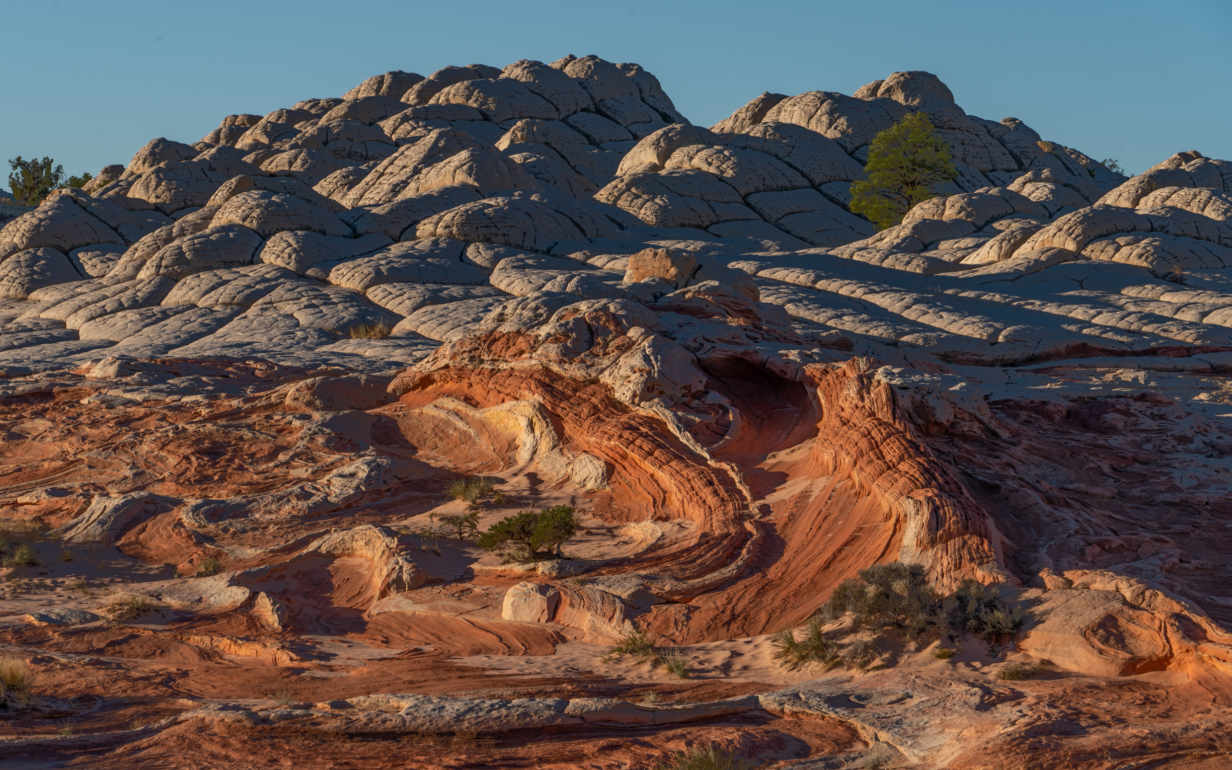
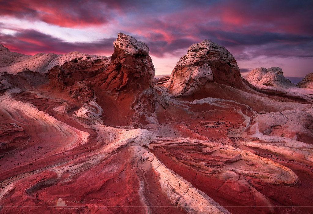
Flickr on the other hand offered some great images (see the below slider) by several talented photographers that helped me develop my subject list. Note that several of these photographers offer tours to this location, which might be something that would offer some tremendous value, as well as transportation to this location.
Besides referencing Instagram and Flickr, and Wave.info to identify a few potential subjects, I used the Photographer’s Ephemeris to plot the seasonal sunrise and sunset cycle as shown below. What this pointed out was that during my projected visitation date I couldn’t count on optimum texture lighting during the first and last light of these Golden Hour periods. This is because the plotting of the October and November sunrises and sunset showed that the Eastern buttes were blocking most of the first light. Only between March 3-5 and October 6-8 were windows that would provide first light.
Sunset would offer a greater length in the number of days with the last light texture lighting available from April 17 through August 19. But this would be hitting the Northwestern exposure of White Pocket. The rest of the time, the Western butte blocks as does the outcropping mounds of brain rock.
![]()
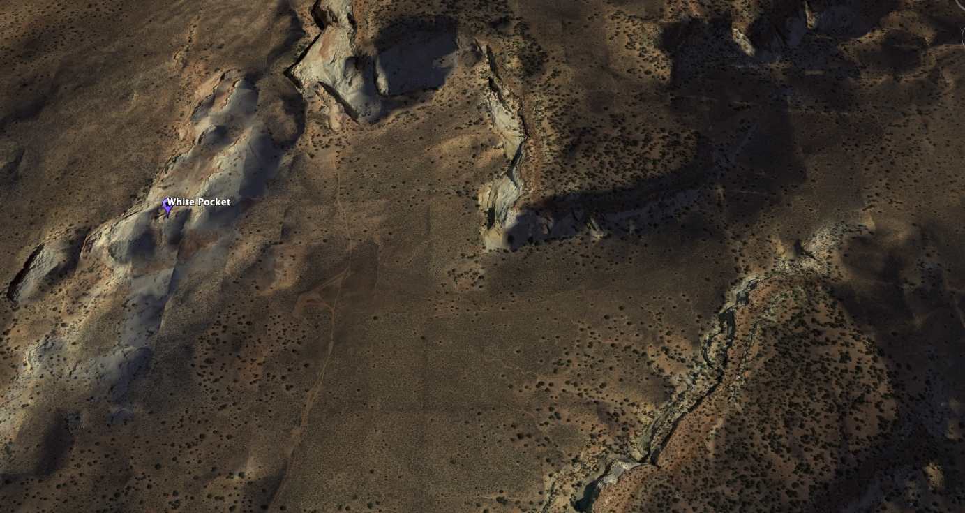
This of course meant that I needed to look at shadowing from the first and last light using Google Earth’s desktop application’s feature to simulate sunlight and shadows. The following two screen captures reveal Google Earth’s simulation of the first light impact in the first image and the last light impact in the second image for the period I was planning to be there.
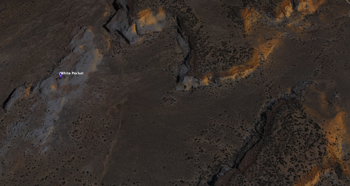
Here is what the last light showed for the evening that I planned to be there.
So what these images were telling me was the blue hour, nighttime, or filtered light from an overcast day were the shooting periods I should plan for.
Since nighttime was a valuable option, I decided to plan for a Milky Way shot. PhotoPills offered some good news in that the Galactic Center during my visit would be visible between 7:04 PM to 8:17 PM provided no cloud obstruction. PhotoPills’ augmented reality feature also suggested that the Milky Way would be in a vertical or nearly vertical perspective when shooting towards the Southwest. However, my misfortune was that it was an overcast evening. So while I lost the Milky Way, I did get some interesting sky that matched the tonal conditions of the landscape.