
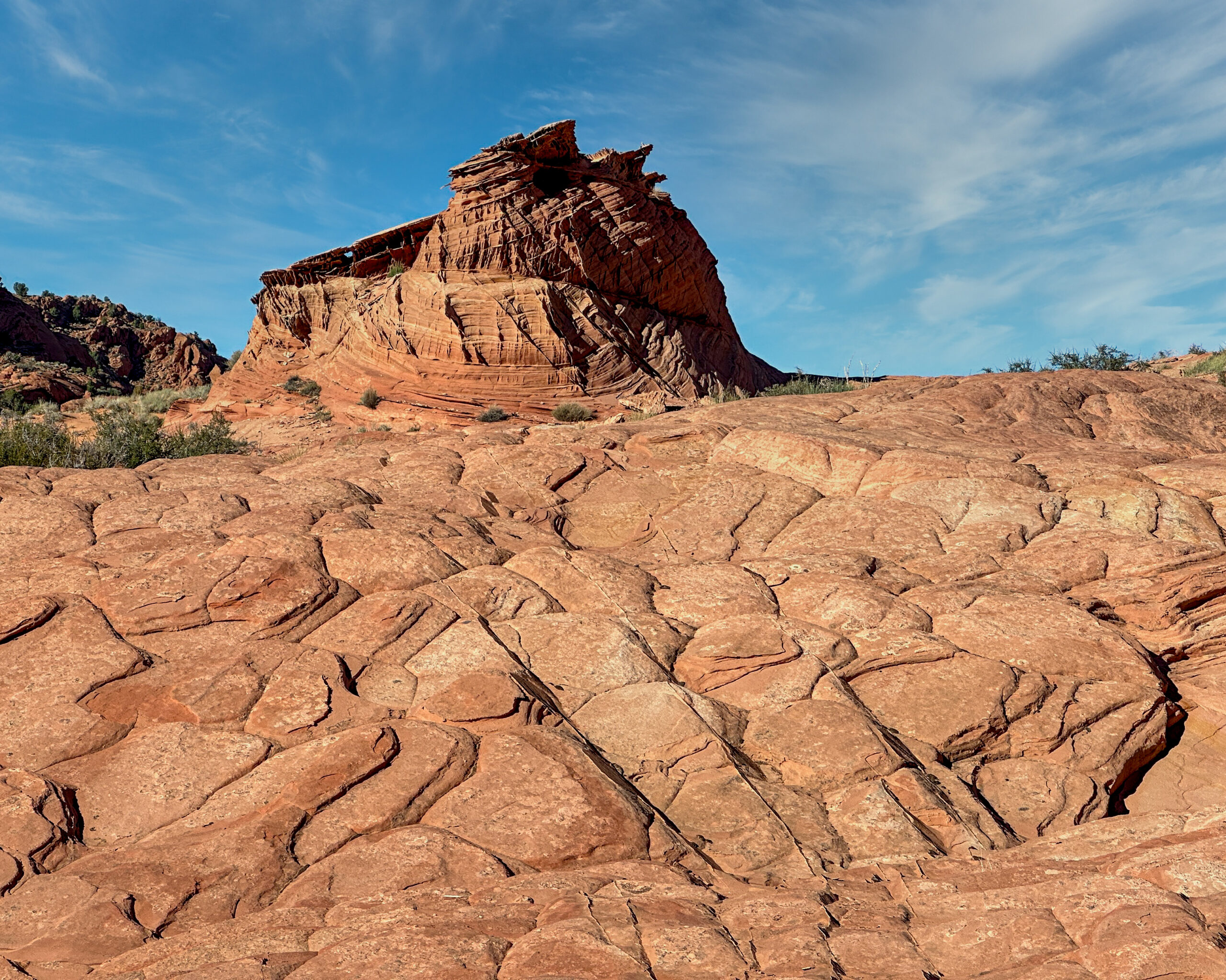
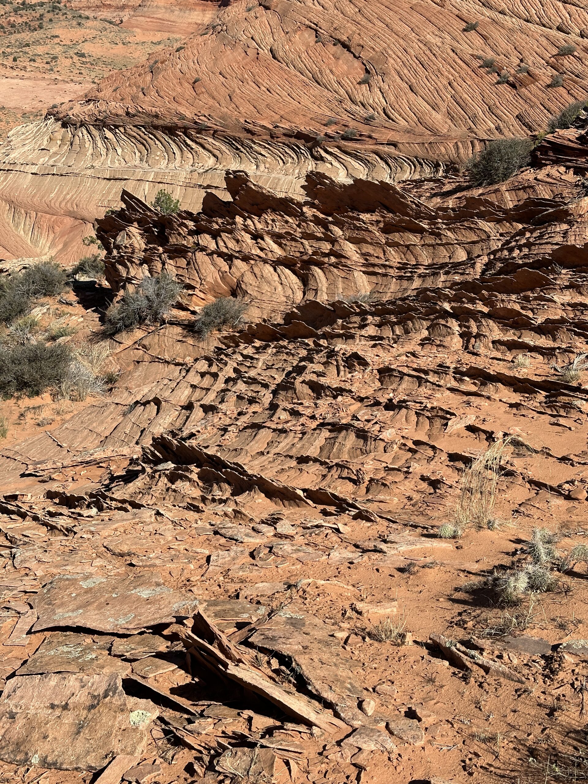
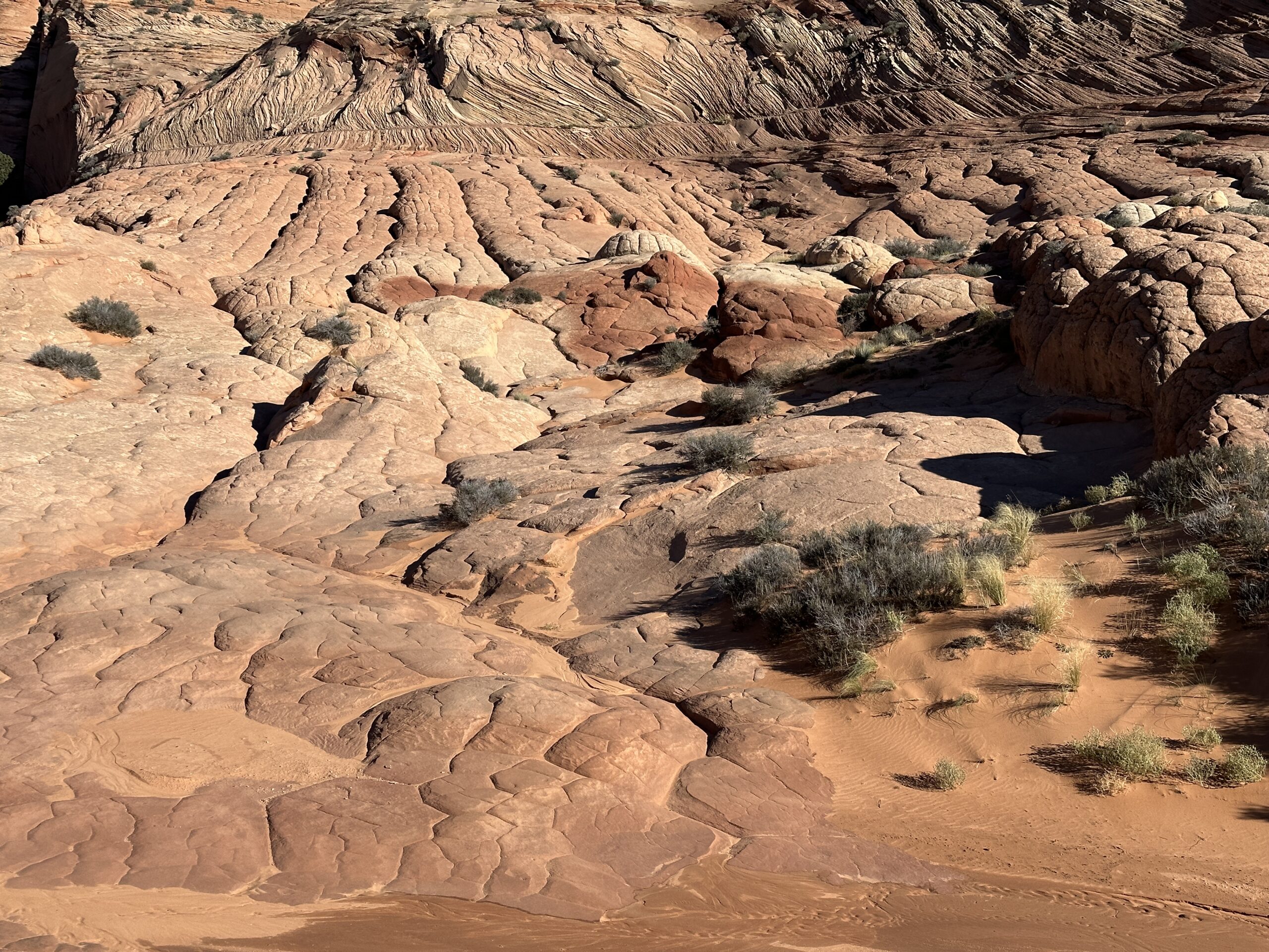
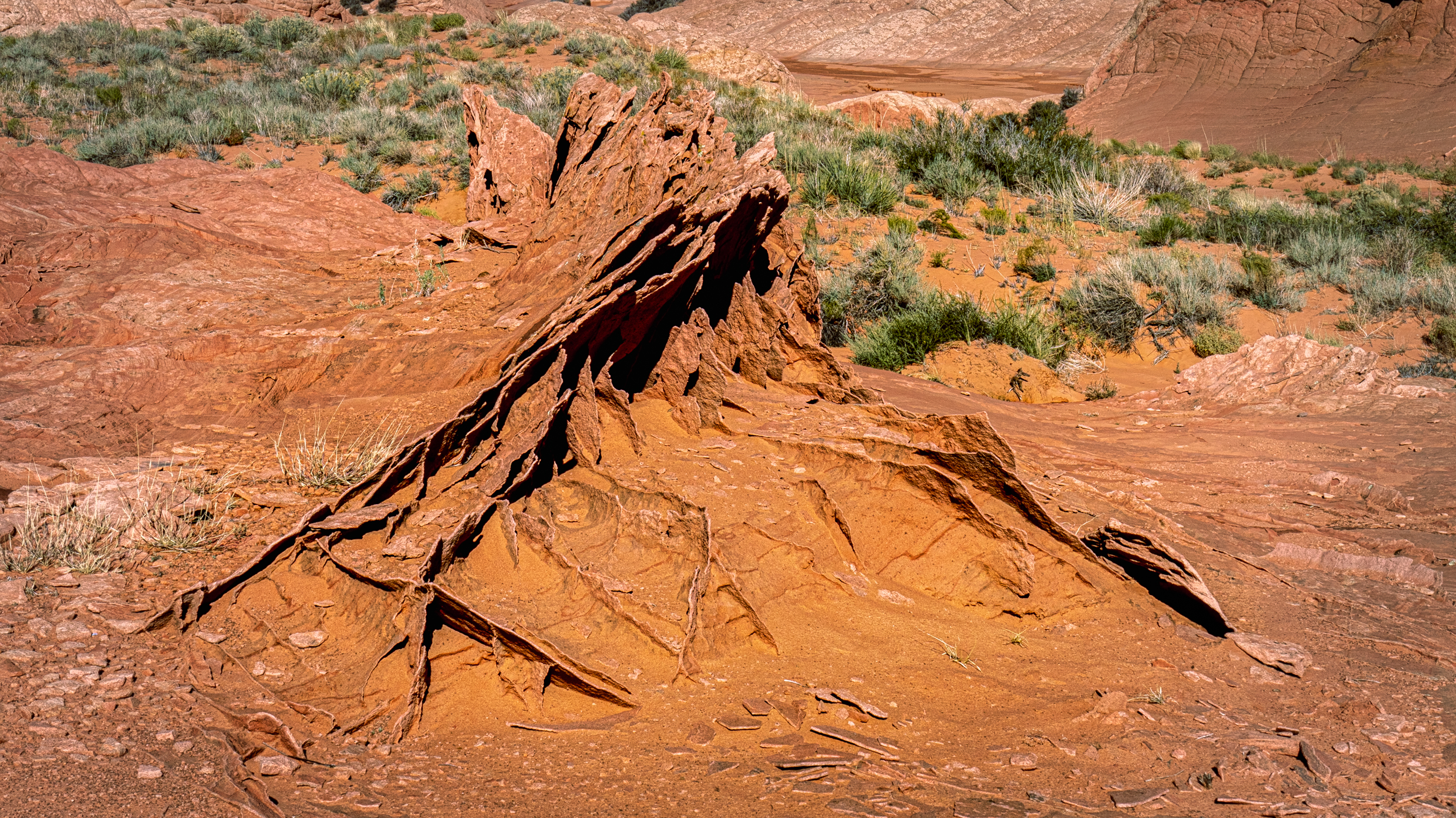
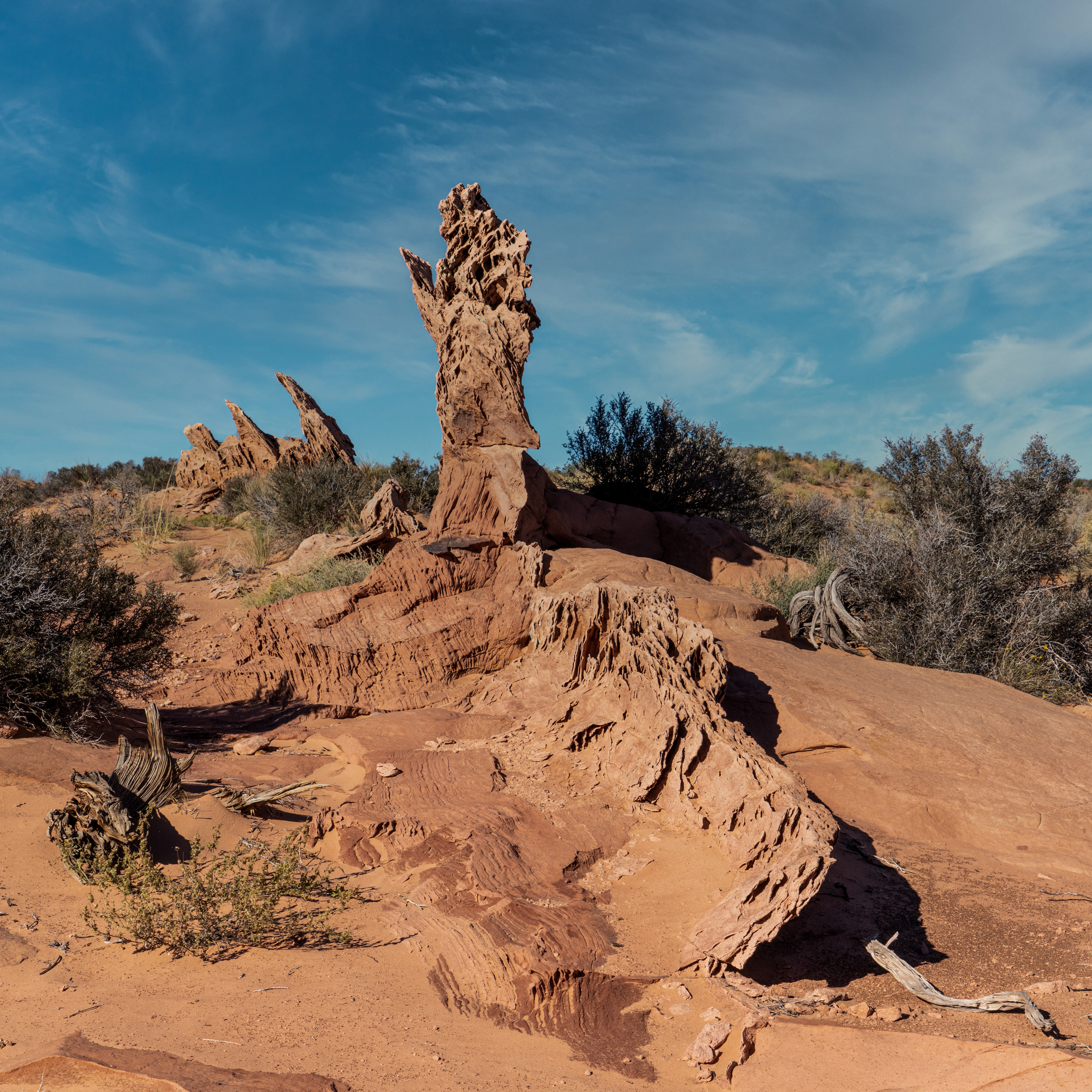
The plan for the 2022 trip to Southern Utah and Northern Arizona area centered on locations nearby to my upcoming hike to the Wave. Looking at the well documented website TheWave.info for adjacent locations of interest I found some intriguing information about this area known as Edamier’s Secret, which is East off the Buckskin Gulch trail. It is known for the lace and brain rock that is scattered throughout this area in various patterns like rope rock and crossbedding.
These unique types of rock formations intrigued me and the short 2 plus mile trip into the area suggested this was a good location to test out my new day pack loaded with my camera gear, water, and a few other survival items before I would have to hike the Wave the next day. It also would help me fine tune my photography skills in both the technical skills and compositional understanding to capture these unusual images. So to me if was the perfect day before hiking the wave trial and one that I could do in the afternoon after attending the suggest “Hike the Wave” orientation briefing.
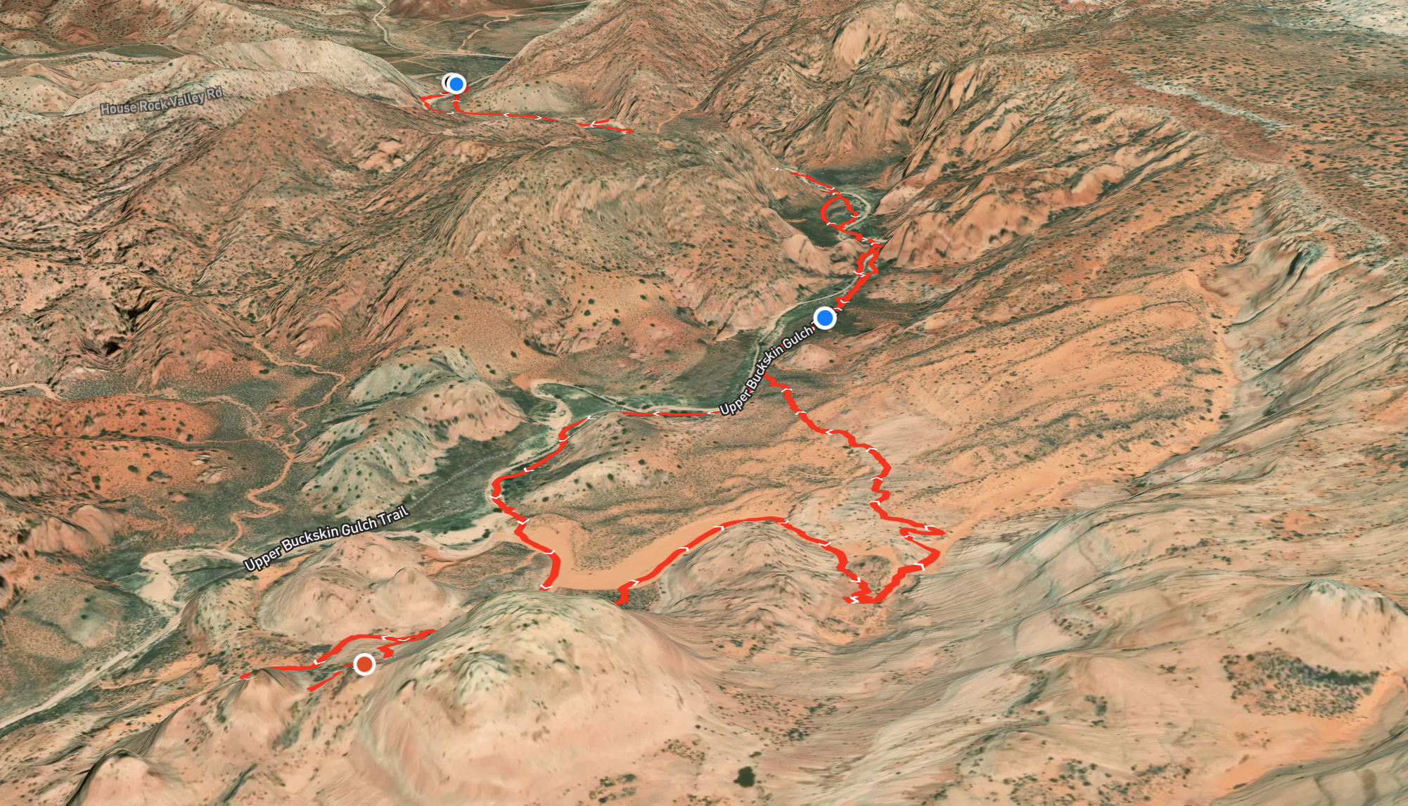
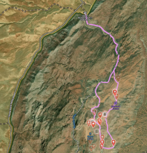
Edmaier’s secret is named after a German geologist named Bernhard Edmaier, who was photographer and author of several geoscientific books. While Edmaier’s Secret has now replaced Brown Pocket as the name tagged in Google and BLM maps, it isn’t a location that is as popular as either of the trails that you have to use to enter this area. When I looked at which trail to use, Buckskin Gulch or Wire Pass, I elected to use Buckskin Gulch to avoid what I considered would require an initial steep elevation scramble or hike within what I suspected was a wet slot canyon. As it was, my elevation gain on the trail loop shown in the featured image was 312 feet, but I didn’t go to all the suggested sites illustrated in TheWave.info map photo gallery that is available as a shared tagged map by that website’s author. Nor did I follow my planned route because of the rain the day before made the several water crossings a bit more challenging.
The other reasons for not following my planned trail was that I met up with a couple from Austria and lost track of my bearing while enjoying my conversation with them. The final factor was that there is this fence line that ran parallel to the Buckskin Gulch trail and mislead me that it wasn’t an area I should cross over into. But finally I broke off my conversation with the couple and saw a location where the barbed wire was laying down and crossed over.
What I soon found out upon entering this area is these unique formations illustrated in that photo gallery aren’t that easy to find because many aren’t very large in size, they are dispersed throughout the area, and several are tucked away out of view as you walk along the lower terrain. That means start looking around and have some idea of what the formation might look like that you are searching for. This is because I soon discovered there are other formations that are out there that haven’t yet been photographed and referenced on the internet. Also be prepared to have to do some scrambling cause some of these formations are up some steep slopes and hill tops. So hope you go and enjoy. Here are the images I took while enjoying my exploration to include a couple taken using my iPhone.